
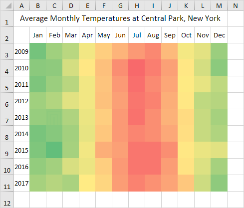
To create a heat map in Excel, simply use conditional formatting. A heat map is a graphical representation of data where individual values are represented as colors.
To create a heat map, execute the following steps.
1. Select the range B3:M11.

2. On the Home tab, in the Styles group, click Conditional Formatting.

3. Click Color Scales and click a subtype.

Result. A heat map with numbers.

4. Select the range B3:M11.
5. Right click, and then click Format Cells (or press CTRL + 1).
6. Select the Custom category.
7. Type the following number format code: ;;;

8. Click OK.
Result. A heat map in Excel.
Note: you can clearly see that the summer of 2014 in New York was cool and that Christmas 2015 in New York was warm.